
Climate and forest protection in Kafa Biosphere Reserve
Protecting the last cloud forests of Ethiopia

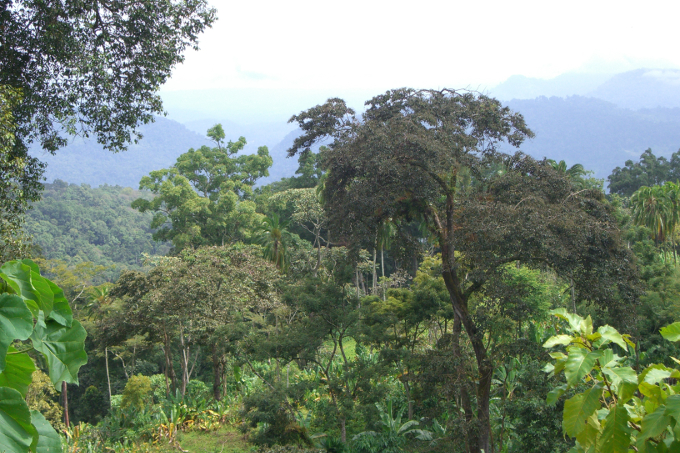
Kafa mountain range - photo: Bruno D'Amicis
The remaining afromontane cloud forests in the southwest of Ethiopia are an exceptional natural heritage site. They're home to numerous animal and plant species, some of them endemic. The region is considered to be the birthplace of Arabica coffee, which includes many of the finest coffee varietals in the world. Its story begins 1,000 years ago in the undergrowth of the forest. Today, around 5,000 varieties grow wild in these forests – an impressive range of genetic diversity.
The afromontane cloud forests are also known as Ethiopia’s green lungs. They ensure rainfall in the region, which feeds into rivers of nationwide importance. The forests are an important source of food and income for local communities. They're also considered an important carbon reservoir, with a significant role for global climate protection due to their immense amount of biomass.
NABU and its partners worked towards the preservation of these forests through the establishment of the UNESCO Kafa Biosphere Reserve in June 2010 and the project: “Climate Protection and Preservation of Primary Forests – A Management Model using the Wild Coffee Forests in Ethiopia as an Example.” The project focused on forest and climate protection, providing support to the Kafa Biosphere Reserve and improving the livelihoods of the local communities. It was funded by the International Climate Initiative (IKI) courtesy of the Federal Ministry for the Environment, Nature Conservation, Nuclear Safety and Consumer Protection (BMUV, formerly BMUB).
-

Praying mantis in Kafa Biosphere Reserve - photo: Bruno D'Amicis
-

A farmer shows the ripe fruit of a wild coffee shrub - photo: Bruno D'Amicis
-

Giants of the rain forest - photo: Rainer Klingholz
-

Local communities are actively involved to preserve the environment of Kafa. - photo: Angelika Berndt
-

Kaffeekirschen - Foto: Rainer Klingholz
-

The Colobus monkey is one of five ape species at the Kafa Biosphere Reserve - Foto: Bruno D’Amicis
Project details and impressions
Project results
The project activities were developed along ten categories. Within these categories, the project achieved the following results:
1. Climate protection: reduction of emissions from deforestation and degradation by approx. 150,000 tons of CO₂ annually since the start of the project, totalling 600,000 tons of CO₂ from 2010 to 2013.
2. Alternative wood supply: set-up of 1,500 hectares (5,000,000 seedlings) of firewood plantation as community forests providing alternative wood supply.
3. Sustainable forest management: transfer of 10,000 hectares of forest area to Participatory Forest Management (PFM).
4. Reforestation: reforestation of 734 hectares of degraded natural forest with native tree species (enrichment planting).
5. Agroforestry: planting of 290 hectares of degraded land and cultivated areas with native tree species in agroforestry systems. This was done jointly with 11,500 community representatives who are also responsible for ongoing maintenance.
6. Wood-saving stoves: introduction of 11,200 wood-saving MIRT-stoves to selected communities reducing dependence on forest resources.
7. Forest- & climate monitoring: implementation of effective monitoring systems for CO₂ emissions and forest health.
8. Eco-tourism: establishment of a tourist infrastructure (e.g. open air museum, guest house, touristic maps, trainings in eco-tourism, etc.) in at least 5 regions of Kafa Biosphere Reserve and creation of respective business plans.
9. Ranger Team: training of 30 rangers to patrol Kafa BR core zones, educate local communities about climate and forest protection, and assist with the project implementation.
10. Raising environmental awareness: information campaign raising awareness about the biosphere reserve and the importance of forest preservation for climate protection, including the training of 374 key stakeholders (192 local tribal leaders, 102 community representatives in key roles, 50 local government representatives, 30 rangers).
Forest conservation and management
Within the framework of the project, step-by-step action was taken to preserve the cloud forests:
1. Forest and community analysis: To lay the foundation for all following activities, an initial analysis was conducted. It served as one of the first cornerstones of the overall project. During a timeframe of six months, we selected appropriate sites for reforestation, establishment of community plantations and agroforestry systems. To achieve this, we combined satellite image interpretation with geoprocessing and live discussions with forest stakeholders. Find the full community and forest analysis report here.
2. Climate and forest monitoring: Regular analysis of the forests' state was conducted. This included measuring forest fragmentation, growth or shrinking, biomass, and carbon storage. Experts quantified the effects of the project on CO₂ emissions. Forest inventory was repeated every two years and at the end of the project.
3. Reforestation program: 500 hectares of degraded forest and 200 hectares of farmland identified in the initial analysis were reforested with native tree species and crops. 18 tree nurseries were established all over the Kafa Biosphere Reserve. In total, about 350,000 trees were planted during the project resulting in improved ecosystem services for local communities (e.g. more non-timber forest products, like coffee, fruits, medicine, spices, honey, beeswax etc.) and increased carbon storage.
Ranger team and multiplier program
Creating new job opportunities for the local population was an essential part of the project. As part of this initiative, a team of 30 rangers was trained. The training included topics like biodiversity, importance of forests for climate protection, ecotourism, and more. Upon completion of their training, rangers were equipped to accomplish the following tasks:
- patrol core project zones
- forest monitoring
- supervision of reforestation (and other project components)
- advise local residents on sustainable agricultural methods (e.g. ecological forest & soil management)
- distribute energy-saving stoves to local communities
- serve as influencers or "multipliers", raising awareness among the local population for climate and forest conservation matters
- guide tourists and provide visitors with information on the biosphere reserve.
The full ranger training manual can be downloaded here.
Integrating local communities and livelihoods
Several project components aimed at integrating the local population into the project efforts, ultimately improving their livelihoods in harmony with nature:
1. Community plantations: Local residents need firewood mainly for cooking and heating. Before the project, wood had been collected by the locals in an unorganised fashion, oftentimes leading to deforestation of precious cloud forests. To protect the forest and provide alternative wood sources, community plantations with fast growing trees for firewood production were established. As a consequence, less natural forest was destroyed and carbon dioxide emissions through deforestation were reduced. New community plantations sequester substantial amounts of CO₂ from the atmosphere, adding to the carbon stock. Community plantations are popular in Ethiopia for their positive social and environmental impact. Jobs are being created for the establishment and management of these plantations. From an environmental point of view, community plantations support soil and water conservation, harbour wildlife and birds, and modify micro-climate.
2. Participatory Forest Management (PFM): The idea of PFM, in a nutshell, is to put certain areas of the forest – in this case 10,000 hectares across 16 areas – under shared long-term ownership of local communities. The goal is to incentivise sustainable sources of income for the population, e.g. harvest and sales of non-timber forest products (NTFPs), such as coffee, fruits or spices. By promoting NTFP production and trade, a link could be created between poverty alleviation and forest conservation. To implement the PFM system, NABU teamed up with the Kafa Coffee Farmers Cooperative Union to contract a team of four local experts plus one coordinating team leader. As a team, they planned, set up and executed the PFM program.
3. Energy-efficient stoves: About 96 percent of Ethiopia's energy is generated using biomass. Cooking is often done on open fires. Many households satisfy their demand for firewood by cutting trees from the available natural forests and shrub lands (see also 1. Community plantations above). This leads to increase in deforestation, negative carbon dioxide effects, and more time spent by women and children on firewood collection. To counteract these negative effects, the project introduced and distributed so-called MIRT stoves to the local population. ‘Mirt’ means ‘best’ in Amharic, and these eco-stoves are used for baking Injera, a pancake-like thin bread made of teff flour which is native to Ethiopia. MIRT stoves allow for cooking and boiling food without the use of additional fuel. Tests revealed a fuel saving of about 50 percent (wood and kerosene) and kitchen carbon monoxide (CO) concentration reductions of about 90 percent compared with open fire [source: kindutrust.org]. Increased efficiency and the resulting decrease in wood consumption not only saves the forests, it also saves time for the user and produces less smoke and fire. The stoves are therefore a source of great relief and convenience to the people and consequently became increasingly popular in Ethiopia. To produce and distribute a minimum of 10,000 MIRT stoves, NABU worked closely with the Kafa Zone Department for Water, Mines and Energy. 50 young unemployed people were trained as stove producers and supported as entrepreneurs to succeed with their business. Today, they produce up to 30 stoves per day. They receive requests from other local people who are convinced of the stoves' advantages and want to purchase them for their own household. Find the full report on the introduction of energy-efficient stoves here.
4. Climate-friendly micro credits: Micro credits are loans given to individuals who do not qualify for a conventional bank loan. These loans are meant to be used for income-generating activities that will improve the borrowers' living standards. In order to qualify for a micro credit, the borrower must present a coherent concept with a business plan. Preferential support will be given to women in order to strengthen their role within society, as well as non-landowning young people, and farmers with sustainable practices. According to the United Nations, an astounding 98 percent of all micro credits are paid back. The concept of micro credits has been very successful throughout the world: 500 million people worldwide have made use of this effective tool for self-aid during the past 30 years. Micro credits can be tailored in such a way that they incentivise and contribute to sustainable practice. That was our approach for Kafa Biosphere Reserve. Micro credits were given out for the following purposes:
- seed stores, seedlings or equipment for tree nurseries with indigenous or fast-growing tree species (sale of wood or seedlings, with simultaneous reduction of burdens on the forest)
- seeds or equipment for agriculture (self-sufficiency and sale of agricultural produce, coupled with reduced burden on the forest through less gathering of non-wood products)
- seeds or equipment for alternative forage crop cultivation (improvement of animal husbandry and thereby income from it through simultaneous reduction of unrestricted grazing)
- setup of regional product marketing with the Kafa Biosphere Reserve logo (spices, honey, etc), raising living standards through earnings and generation of value consciousness for regional products
- activities within the tourism sector (accommodation such as bed and breakfasts, taverns, sales of handicrafts, etc)
- credits for small solar-powered engines (Improvement of living/producing conditions)
- irrigation plans to aid subsistence agriculture (improvement of agricultural production and thereby income from sale of produce)
- education or equipment for medicinal crop plantation (income from the sale of medical drugs, with simultaneous reduction of burden on the forest due to less gathering in it)
- micro-enterprises, such as the set up of kiosks (improving living standards through income)
- communication devices, such as mobile phones or computers/laptops (income from renting)
Ecotourism
The Ethiopian government views tourism as a key future income source, with increasing international visitors each year. Kafa, rich in natural attractions and the origin of Arabica coffee, holds great potential for ecotourism. Efforts have been made to improve the region's infrastructure, including better roads and the expansion of Jimma Airport.
Our project developments included a management and business plan for ecotourism in the Kafa Biosphere Reserve, the creation of "wild coffee experience" trails, wildlife observation towers, picnic sites, and an open-air cultural museum. The project also focused on enhancing local tourism services through training and supporting community-based initiatives to make Kafa more attractive to visitors and boost the local economy.
Campaigning and communications
The Kafa Biosphere Reserve project’s campaigning efforts can be summarized under the following key areas:
Fundraising & Marketing
NABU secured significant financial support from international partners, including the German Federal Ministry for the Environment, Nature Conservation, Nuclear Safety and Consumer Protection (BMUV, formerly BMUB). Additionally, NABU reached out to coffee-related private companies to generate interest and secure sponsorships, particularly for programs aimed at preserving the genetic diversity of wild Arabica coffee in the Kafa region. Marketing efforts also included the production of a short film about the Kafa Biosphere Reserve and the inclusion of the region in the portfolios of specialised travel agencies, promoting eco-tourism as a means to generate sustainable income for local communities while raising global awareness about the region's ecological value. Find the full marketing concept here, and the fundraising strategy here.
Local Communication
Engaging the local communities was a cornerstone of the project’s success. NABU implemented communication strategies that were tailored to the cultural and social contexts of the region. For example, traditional Ethiopian coffee and tea ceremonies were utilised as platforms for discussing environmental issues with local residents. These ceremonies, which are culturally significant and widely respected, provided an accessible and informal setting for raising awareness about conservation. Furthermore, educational programs targeted schools and youth clubs to involve children and teenagers in the conservation effort, teaching them about the significance of their local environment and encouraging them to become active participants in its preservation. (Our comprehensive youth-to-youth training manual can be read here.) The integration of both traditional and modern communication methods ensured that the project’s messages were effectively disseminated throughout the local population.
Global Communication
The project’s global communication efforts aimed at raising international awareness and support for the Kafa Biosphere Reserve. Key activities included the creation of a project website that provided comprehensive information about the reserve and its conservation goals. Additionally, NABU produced project flyers and banners that were distributed and displayed at international events and conferences. Publications were also vital communication elements, helping NABU share findings, strategies, and successes with a global audience. Regular newsletters were published to keep stakeholders informed about the progress and impact of the project. These efforts were crucial in establishing a strong international presence and ensuring that the conservation message reached a broad and diverse audience.


Project facts
Project title
Climate Protection and Preservation of Primary Forests – A Management Model using the Wild Coffee Forests in Ethiopia as an Example
Country/Region
Ethiopia, Kafa
Period
2009 - 2014
Partners
SNNPR (Southern Nations, Nationalities and Peoples Regional State)
Kafa Zone Administration
Subcontractors
Wageningen Universiteit
GeoSYS
E.C.O.
EWNHS
SDPASE programme (EWCA)
Kafa Forest Coffee Farmers Cooperatives’ Union
South West Ethiopia Peoples' Region (SWEPR, formerly SNNPR)
Sponsored by / Supported by
The project was supported by the International Climate Initiative (IKI) of the Federal Ministry for the Environment, Nature Conservation, Nuclear Safety and Consumer Protection (BMUV, formerly BMUB).
MORE

ForestConnect
Fragmentation and degradation are threatening Ethiopia's diverse forest landscapes and thus the country's biodiversity and food security. In Southwest Ethiopia, NABU and its partners are therefore implementing action plans to restore the precious forests. more →

A Highlander in Ethiopia
Dragonflies are charismatic insects: Their traits include spectacular aerial maneuvers, jewel-toned bodies and an important role in the ecosystem. More than 6,400 dragonfly species worldwide are known to science. One of them is the “Ethiopian Highlander”. more →

Climate Change
Climate change and biodiversity loss are the most pressing challenges to humanity. Finally, people start to realize they are both sides of the same coin. NABU stands with science. We demand and support all efforts to reach a net-zero carbon economy globally. more →